Need to get out of town fast and find some high desert solitude and beauty?
Head for the bottom of La Bajada Hill on Interstate 25 and then follow the frontage road, NM 16, back around to Galisteo Dam.
It’s a lonely remote place where one can really find some space.
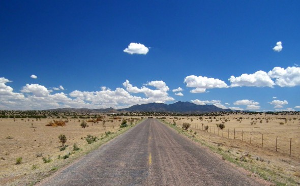
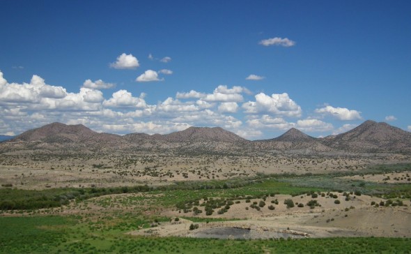
Located just 30 minutes south of Santa Fe and about six miles east of the interstate, the flood and sediment control dam at the far end of a secluded, paved road features sweeping views of the Ortiz and Jemez Mountains and the back side of the Cerrillos Hills State Park.
There’s no water here to draw typical recreational users which makes the dam site such an intriguing and unusual place to visit.
And although a big sign says “Stop” and “Road Closed” on the locked gate barring vehicle traffic to the dam’s overlook and picnic area, Becky Minor, manager at Cochiti Lake for the United States Army Corps of Engineers (USACE) says the facility is free and open to the public.
“It’s a nice quiet place with lots of solitude and great views of the mountains,” she says.

The road into the Galisteo Dam site is gated most of the time to prevent damage to the remote facility.
But vandalism at the remote site has been a problem which has resulted in increased security measures such as the locked gate, she said.
Visitors can park just outside the gate at a couple of roadside pull outs and hike a short way into the overlook area or across the two mile wide dam.
Those who like to walk, perhaps with their dogs, might find the hike across the top of the lengthy, 160-foot high, earthen dam an enjoyable experience.
The six mile ride in to the dam site on NM 16 with little or no traffic to contend with might be a compelling reason for bicyclists to visit.

The road to Galisteo Dam is remote and provides a fine view of the Ortiz Mountains off in the distance.
Landscape artists and photographers might also find the surrounding views creatively stimulating.
And weather watchers who enjoy the excitement of an afternoon thunderstorm can, from the relative safety of the overlook bunker, easily observe one as it rolls across the expansive landscape below.
Visitors should keep in mind that the area is comprised a patchwork of public, private and Indian lands much of which is not conspicuously posted and thus stick to the road and immediate dam site.
Firearm use is strictly forbidden on Santo Domingo Pueblo lands which surround the dam.
The dam site itself sits on about 5 acres of land and features little more than the massive structure itself and some dilapidated picnic shelters at the overlook.
But visitors might be surprised to find that a remarkably clean, well equipped, modern vault toilet is available just inside the gated area.

A brand new, clean, functional outhouse was found open at the Galisteo Dam during Outdoors New Mexico’s visit.
The dam was built in the late 1960’s as part of the Cochiti Lake flood control project for the Rio Grande, according to the 1985 historical account of the Army Corps of Engineers Albuquerque District by Author Michael Welsh.
The book provides fascinating reading for anyone interested in southwest water development as well as a historical accounting of many of New Mexico’s most prominent and storied political players.
In the end though the Cochiti project went through and now provides great recreational opportunities to Albuquerque and Santa Fe area residents including fishing, boating, swimming and other outdoor activities.
An online PDF version of the book can be downloaded from the USACE’s digital library at http://cdm15141.contentdm.oclc.org/cdm/singleitem/collection/p16021coll4/id/137/rec/4

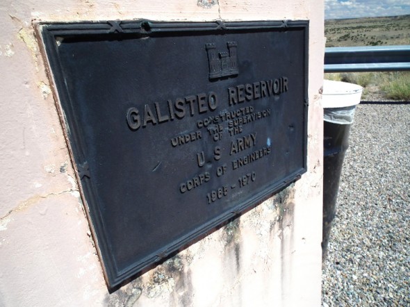
A marker shows when Galisteo Dam was built but otherwise there is little to be found at the site to indicate it’s purpose and history.
Galisteo Dam was built as part of the overall Cochiti project to limit the damage flooding in Galisteo Creek was doing to the Rio Grande floodplain.
Welsh’s book notes how flash floods in Galisteo Creek frequently swept away unsuspecting motorists late at night on portions of US 285.
The dam structure is designed to withhold sediment while allowing flood waters to gradually flow through the dam and wash downstream to the river.
And today it stands silently at the end of lonely dirt road far back in Indian country awaiting its chance to do just that.
In the meantime those seeking a change of pace from the usual outdoor recreational venues around Santa Fe might just want to venture south to this remote outpost.
Visitors should exercise caution due to the remote location and secure valuables out of sight when left in a vehicle.
Visitors should also protect themselves from the sun, drink plenty of water and stick to established trails when visiting the dam.
For more info call the Corps Visitor Center at Cochiti Lake at 505-465-0307 or visit their website at http://www.spa.usace.army.mil/Home.aspx
If You Go: Take I-25 south to the Cochiti turnoff at the bottom of La Bajada Hill and then bear left on the bridge across the freeway and follow NM 16 past the asphalt plant turnoff and all the way around to the end at Galisteo Dam.


